Maps and Information
There are many parks located in Garfield Township offering a variety of recreational opportunities.
TOWNSHIP-OWNED PARKS
Garfield Township offers a wide variety of recreational opportunities in its parks. Click on each link below to find out more information about that specific park.
Boardman Valley Nature Preserve
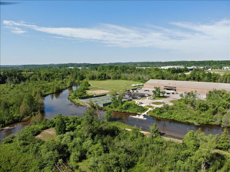 This 158-acre park is located along both sides of the Boardman-Ottaway River, south of South Airport Road. The park offers opportunities for hiking, fishing, canoeing, kayaking, tennis, beach volleyball, soccer, cross-country skiing, snowshoeing, hunting (with prior Township approval), nature watching, pickleball courts, and an ADA-accessible kayak launch. The park includes over a mile of river frontage and about 1.5 miles of nature trails.
The park is currently accessed via the parking lot adjacent to the South YMCA on Racquet Club Drive. Public restrooms are available within the YMCA building. For recreational opportunities at the YMCA, please follow this link: Grand Traverse Bay YMCA
Grand Traverse Commons Natural Area
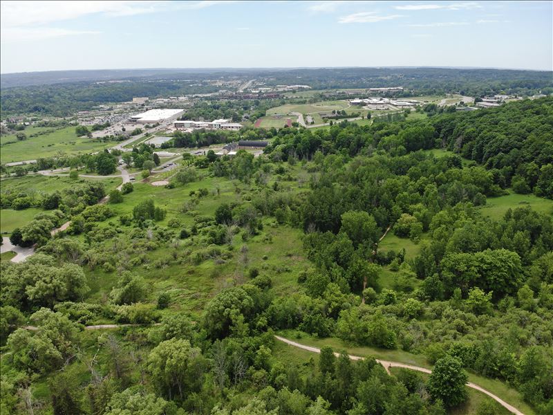 This 140-acre park was dedicated to Garfield Township in the early 1990s and expanded several times since then. The park is a part of the grounds of the former State Psychiatric Hospital and is adjacent to The Village at Grand Traverse Commons, a redevelopment of the old State Hospital with a mix of retail, office, and residential uses.
Miles of nature trails offer opportunities for hiking, biking, nature watching, and cross-country skiing. Dogs are welcome but must be leashed. Restrooms are not available on site.
Directions to North Long Lake Road Trailhead
Directions to Red Drive Trailhead
Directions to Copper Ridge Trailhead
Kids Creek Park
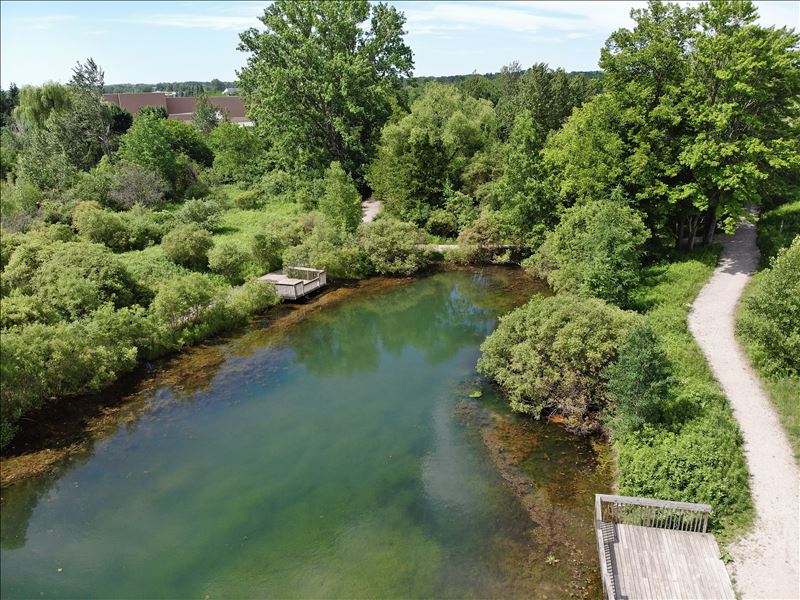 The 20-acre Kids Creek Park was dedicated to the Township during the development of Great Wolf Lodge. The 3/4-mile trail network includes wooden bridges and boardwalks following Kids Creek, which meanders though the park. The trails within the park connect to Buffalo Ridge Trail nearby. The park is also a great family fishing destination with fishing available in the creek as well as Oleson Pond, which is stocked with bluegill and trout!
Many volunteers have contributed to efforts to restore the natural beauty of the park. The stream banks had been damaged by decades of buffalo traffic (the former buffalo herd was once the largest east of the Mississippi River) and erosion, and volunteers have helped to restore the banks. Other past projects have included re-routing the creek to allow for upstream migration of fish, and dredging of Oleson Pond.
Kids Creek Park is accessed via the parking lot between Kohl's and Bed Bath & Beyond (look for the "Exit" sign). Non-motorized access is via a trailhead along the US 31 bike path. Public restrooms at the site are not available.
Directions to Kohl's Parking Lot Trailhead
Directions to US-31 Pedestrian and Bicycle Trailhead
Miller Creek Nature Reserve
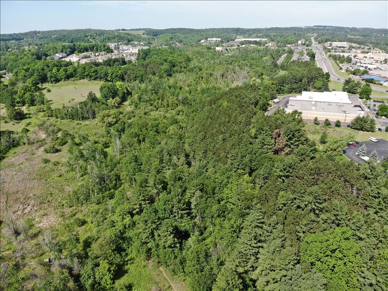 Just behind the Grand Traverse Crossings Mall on South Airport Road, you can find the 88-acre Miller Creek Nature Reserve. The park offers opportunities for hiking, nature watching, hunting (with prior Township approval), cross county skiing, and snowshoeing. The park was developed in phases, first as an open space element of Grand Traverse Crossings, and expanded as a conservation element of the Arbors Apartments on Hartman Road.
There are currently two trailheads accessed via the Crossings Mall; one behind Planet Fitness and one near Resurrection Life Church on Crossing Circle Drive. The trails can also be reached starting at the northwest corner of the Sabin Data Center site at the intersection of Hartman and Cass Roads. Public restrooms are not available on site.
Directions to Church Trailhead
Directions to Planet Fitness Trailhead
Directions to Sabin Data Center Access Point
River East Recreation Area
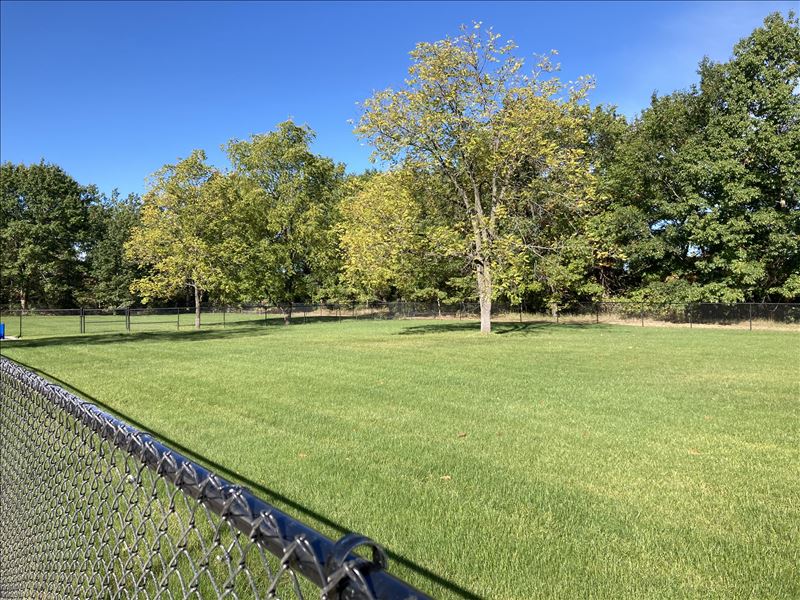 River East Recreation Area is the newest Township park, with the land having been recently acquired with the assistance of a grant from the Michigan Natural Resources Trust Fund. The park is situated along the east banks of the Boardman River across from the Boardman Valley Nature Preserve.
Since 2021, recent improvements to the park include a gravel parking area and pavilion. There is also a hiking trail leading down to the Boardman River. This park is anticipated to see additional investment in improvements over the next few years, which may include space for a dog park and additional trails.
There is one picnic pavilion at this park, which may be reserved for events such as family reunions and company picnics. The Park Reservation Application is available on the Parks and Recreation page.
Silver Lake Recreation Area
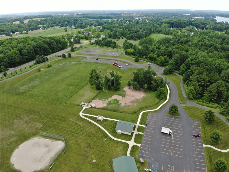 This 84-acre park, located at 1785 N. East Silver Lake Road, has several amenities including a dog park, restrooms, grills, tee-ball field, tennis courts, basketball courts, sledding hill, multi-use field, and trails. The 0.7-mile paved trail loop surrounds the developed portion of the park. About 4,400 feet of unpaved trails meander around Hidden Lake and near the shores of the north branch of Silver Lake. The park has three picnic pavilions available for reservations and are popular for family reunions and company picnics. The Park Reservation Application is available on the Parks and Recreation page.
The Dog Park at Silver Lake Recreation Area is a very popular amenity, and there is even a Facebook page maintained by an active dog park user group. When using the dog park, please be sure to familiarize yourself with the park rules and help others to understand them as well. Please click here for a map of the dog park, and click here for dog park rules.
TOWNSHIP TRAILS
If you are looking for a long walk or a bike ride, check out these trails located in Garfield Township:
Also, take a look at the Township's Non-Motorized Plan Map to see where there are potential opportunities for future sidewalks and trails.
OTHER PARKS LOCATED WITHIN GARFIELD TOWNSHIP
In addition to the parks owned and operated by Garfield Township, there are many other parks located in the Township operated by other entities, which offer a variety of recreational opportunities.
Joint Recreational Authority - Website and Brochure
The City of Traverse City and Charter Township of Garfield Recreational Authority (Joint Recreational Authority) was formed in 2003 under the Recreational Authorities Act of 2000, which permits two or more municipal bodies to form a joint authority for the purposes of acquiring, constructing, operating, maintaining or improving public parks, a public recreation center, a public auditorium, a public conference center, a public museum, or a public historic farm. The Joint Recreational Authority manages four properties, three of which are located in Garfield Township:
- Hickory Forest
- Hickory Meadows
- Historic Barns Park - Website
- The Botanic Garden at Historic Barns Park - Website
Grand Traverse Natural Education Reserve (owned by Grand Traverse County) - Website
- Boardman River Nature Center (operated by Grand Traverse Conservation District) - Website
Hickory Hills Recreation Area (owned by City of Traverse City) - Website
Keystone Soccer Complex (owned by Grand Traverse County) - Website
Medalie Park (owned by Grand Traverse County) - Website
Mitchell Creek Nature Sanctuary (owned by Grand Traverse Regional Land Conservancy) - Website

